10.01 Pforzheim - Dobel
28.8km
Distance
-
Walking time
1174m
Total climb
767m
Total descent
Photos
Stage description
N.B.: We don't have an English description of the stage just yet. We'll give you the German version for now until the English version is ready.
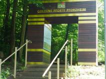
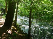
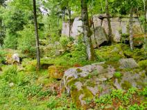
Ab dem Bahnhof Pforzheim ändert sich die Markierung: Anstelle des Andreaskreuzes ist nun die rote Raute des Westwegs maßgeblich. In Pforzheim geht es zunächst an der Nagold entlang bis zum Kupferhammer. Dort beginnen die drei großen Nord-Süd-Wege des Schwarzwalds. Hinter der goldenen Pforte geht der Westweg geradezu als Gebirgspfad steil aufwärts und an Hoheneck vorbei. Dann geht es aber bald an Gärten vorbei wieder abwärts nach Dillweißenstein. Dort wird die Nagold gequert. Dann geht es aufwärts über die Bahn und durch Wohnstraßen, bis wieder Wald erreicht wird. Im Wald geht es bald rechts abwärts hinab zur Enz. Reizvoll führt der Weg dann länger direkt an der Enz entlang. Im Bereich des Bahnhofs Neuenbürg geht es aufwärts zum Schloss Neuenbürg und dann wieder hinab in die Stadt. Auch in Neuenbürg muss man durch Wohnviertel aufwärts gehen, bevor es auf einer Forststraße Richtung Straubenhardt geht. Der Ort Straubenhardt wird am Waldrand umgangen. Nach dem Aussichtsturm auf der Schwanner Warte wird eine Straße gequert und dann geht es wieder mehr durch Wald aufwärts nach Dennach. Von Dennach weiter durch Wald am Volzemer Stein, einer Felsengruppe, vorbei weiter nach Dobel.
The following users contributed to this text:
Hiking maps
No maps added yet
Marking
-
Westweg
Accommodation
| Accommodation | Price group | |||
|---|---|---|---|---|
| 5-15 € | 16-30 € | 31-45 € | >45 € | |
|
Jugendherberge Pforzheim-Dillweißenstein
Pforzheim-Dillweißenstein
Price group: 15-30 €
|
|
|||
|
Show more accommodation in Pforzheim
, Birkenfeld
, Neuenbürg
and Dobel
(booking.com / Ad)
|
||||
Links
Wanderbares Deutschland - Westweg
Information about stages, accomodations and attractions of the Westweg (german)
http://www.wanderbares-deutschland.de/wanderwege/wanderwege-karte.html#westweg
fernwege.de - Westweg
Information about stages and accomodations of the Westweg (german)
Literature
Sources and copyright
GPX track coordinates: © OpenStreetMap contributors. Published under Open Database License (ODbL)GPX-Downloads
You can use the GPX track for navigation and tour planning on your digital device (GPS, smartphone, online tour planner).
| Etappe Stage 10.01 Pforzheim - Dobel | Download (.gpx) |
| All tracks in Germany | Download (.zip) |
The download and many of the services offered on this page are free of charge. However, I would greatly appreciate a small donation as a token of appreciation for my work! This can be done through Paypal or a supporting membership. Thank you very much!


