02.11 Saarijärvi - Kilpisjärvi
18.5km
Distance
-
Walking time
446m
Total climb
609m
Total descent
Photos
Stage description
N.B.: We don't have an English description of the stage just yet. We'll give you the German version for now until the English version is ready.
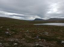
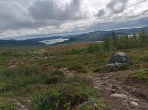
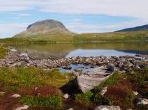
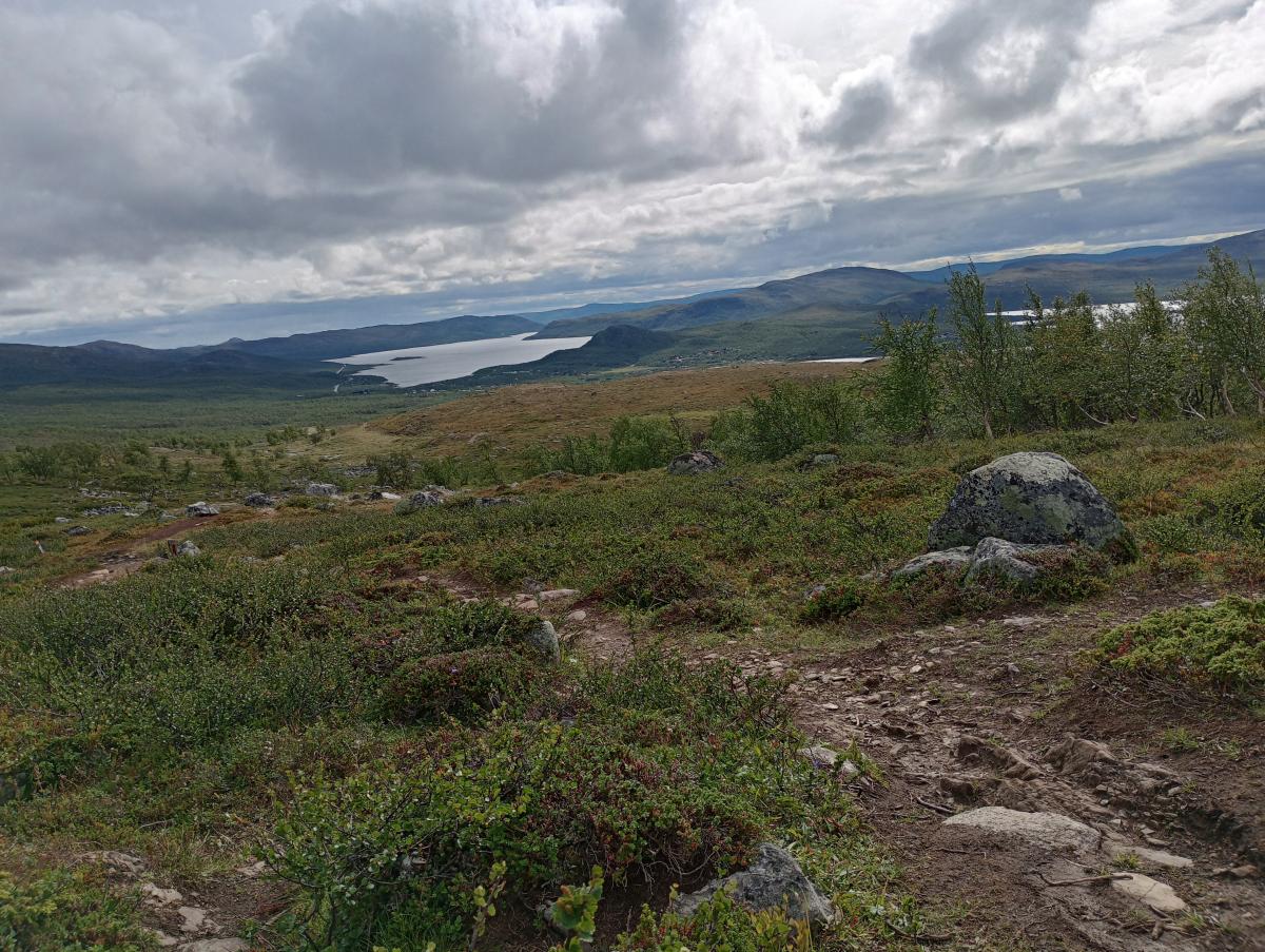
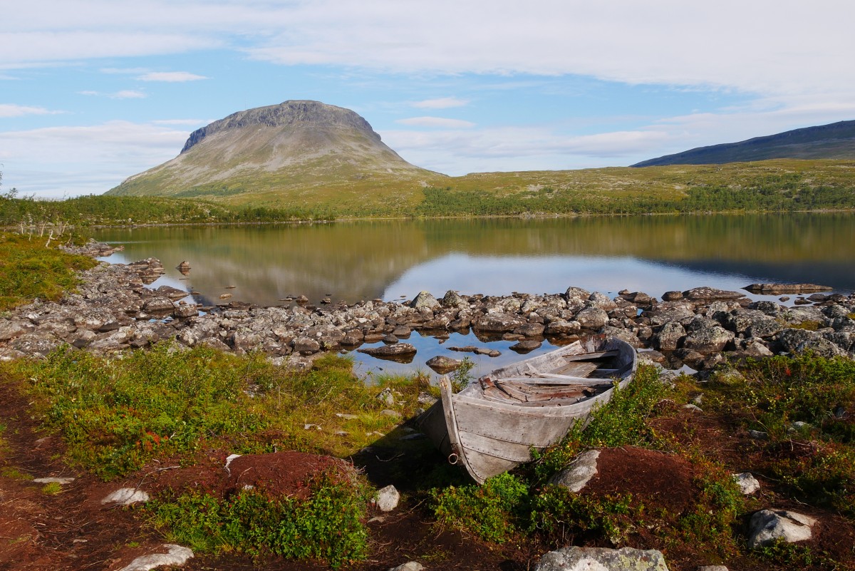
Von der kleinen, zwischen zwei Seen gelegenen Saarijärvi-Hütte geht es Richtung Süden auf Kilpisjärvi zu. Hierbei überquert der Weg kurz die Grenze nach Norwegen, aber außer durch ein paar verwitterte, finnische Schilder am Wegesrand bemerkt man den Grenzübertritt nicht. Je näher man Kilpisjärvi kommt, umso weniger sumpfig wird die Landschaft. Schon bald kommt auch der Saana, der Hausberg von Kilpisjärvi, ins Blickfeld. Mit dem Cahkaljavri erreicht man einen größeren See und ist schon fast zurück in der Zivilisation. Von Süden kommend muss man hier aufpassen, da der breitere Weg am See entlang führt, der markierte Wanderweg aber etwas oberhalb des Sees entlang läuft.
Am südlichen Ende des Cahkaljavri steht eine Hütte und hier befindet sich auch eine Wegekreuzung. Wer direkt auf dem Nordkalottleden weitergehen möchte, kann hier Richtung Westen abbiegen. Wer ein wenig Zivilisation schnuppern möchte, geht auf dem Hauptweg weiter Richtung Kilpisjärvi. Der Wanderweg wird bald zum Wirtschaftsweg und man erreicht das Besucherzentrum, wo man sich z.B. den Schlüssel für die verschlossenen Hütten besorgen kann. Hier trifft man dann auch an die Hauptstraße, wo sich alle Hotels, Restaurants und das Einkaufszentrum von Kilpisjärvi befinden.
Hinter Einkaufszentrum und Tankstelle biegt der Weg wieder von der Hauptstraße ab und führt bergauf in Richtung des Saana. Nach etwa 2 km erreicht man eine Kreuzung und biegt nach links in ein sumpfiges Gebiet ab. Hier beginnt nun einer der unangenehmsten Abschnitte des E1. Für mehrere Kilometer geht es am Berghang über einen sumpfigen Waldweg. Das Vorankommen ist hier sehr beschwerlich, ein paar Bohlenwege würden diesem Abschnitt sehr gut tun. Schließlich endet der Weg am Campingplatz von Kilpisjärvi.
The following users contributed to this text:
Hiking maps
No maps added yet
Marking
Accommodation
| Accommodation | Price group | |||
|---|---|---|---|---|
| 5-15 € | 16-30 € | 31-45 € | >45 € | |
|
Saarijärvi
Price group: €
|
||||
|
Lapland Hotel Kilpis
Kilpisjärvi
Price group: €
|
||||
|
Kilpisjärven Retkeilykeskus
Kilpisjärvi
Price group: >45 €
|
|
|||
|
Show more accommodation in Kilpisjärvi
(booking.com / Ad)
|
||||
Links
DNT - Stage descriptions (PDF)
Detailed information by the DNT about the E1 from North Cape (NO) to Grövelsjön (SE). Including stage descriptions, accomodation, marks and maps. In norwegian language.
Literature
Sources and copyright
Information about accommodation, maps and marking of this stage is based on information by DNT (Den Norske Turistforening) - Published under CC BY-SA 4.0 License GPX track coordinates: © OpenStreetMap contributors. Published under Open Database License (ODbL)GPX-Downloads
You can use the GPX track for navigation and tour planning on your digital device (GPS, smartphone, online tour planner).
| Etappe Stage 02.11 Saarijärvi - Kilpisjärvi | Download (.gpx) |
| All tracks in Norway, Finland and Sweden | Download (.zip) |
The download and many of the services offered on this page are free of charge. However, I would greatly appreciate a small donation as a token of appreciation for my work! This can be done through Paypal or a supporting membership. Thank you very much!