01.05 Stohpojohka - Hattir Øst
20.9km
Distance
-
Walking time
304m
Total climb
433m
Total descent
Photos
Stage description
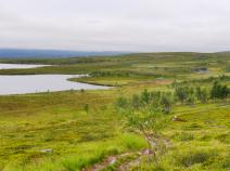
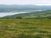
According to the DNT info page (info unfortunately no longer available online), there is a bus from the car park on the E6 road to Russenes (about 5km away) at the end of the stage. There is a hotel with a camping site there, as well as the possibility to buy groceries nearby.
Hiking maps
No maps added yet
Marking
-
DNT Hiking Trail (Norway)
Accommodation
| Accommodation | Price group | |||
|---|---|---|---|---|
| 0-200 NOK |
201-400 NOK |
401-600 NOK |
>601 NOK |
|
|
Stohpojohka
Stohpojohka
Price group:
|
||||
|
Olderfjord Hotell Russenes Camping
Russenes
Price group: NOK 0-200,NOK 200-400,NOK 400-600,NOK >600
|
|
|
|
|
Links
DNT - Stage descriptions (PDF)
Detailed information by the DNT about the E1 from North Cape (NO) to Grövelsjön (SE). Including stage descriptions, accomodation, marks and maps. In norwegian language.
Literature
Sources and copyright
Information about accommodation, maps and marking of this stage is based on information by DNT (Den Norske Turistforening) - Published under CC BY-SA 4.0 License GPX track coordinates: © OpenStreetMap contributors. Published under Open Database License (ODbL)GPX-Downloads
You can use the GPX track for navigation and tour planning on your digital device (GPS, smartphone, online tour planner).
| Etappe Stage 01.05 Stohpojohka - Hattir Øst | Download (.gpx) |
| All tracks in Norway, Finland and Sweden | Download (.zip) |
The download and many of the services offered on this page are free of charge. However, I would greatly appreciate a small donation as a token of appreciation for my work! This can be done through Paypal or a supporting membership. Thank you very much!


