01.02 Skarsvåg Crossing - North Cape Tunnel
19.9km
Distance
-
Walking time
467m
Total climb
486m
Total descent
Photos
Stage description
It is permitted to cross the North Cape Tunnel on foot, but this is not recommended. It is 7 kilometres long.
Source: Norwegian Trekking Association (DNT)
Attention, the following short route description is currently written from south to north:
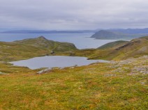
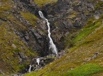
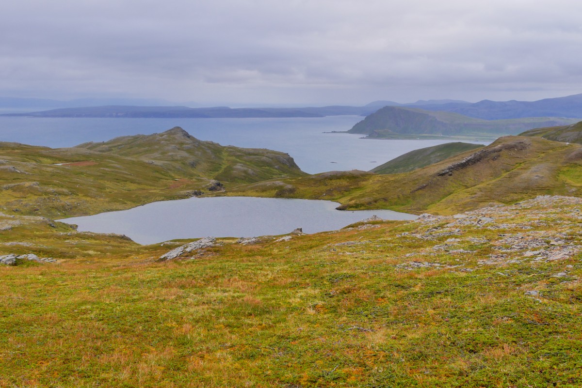
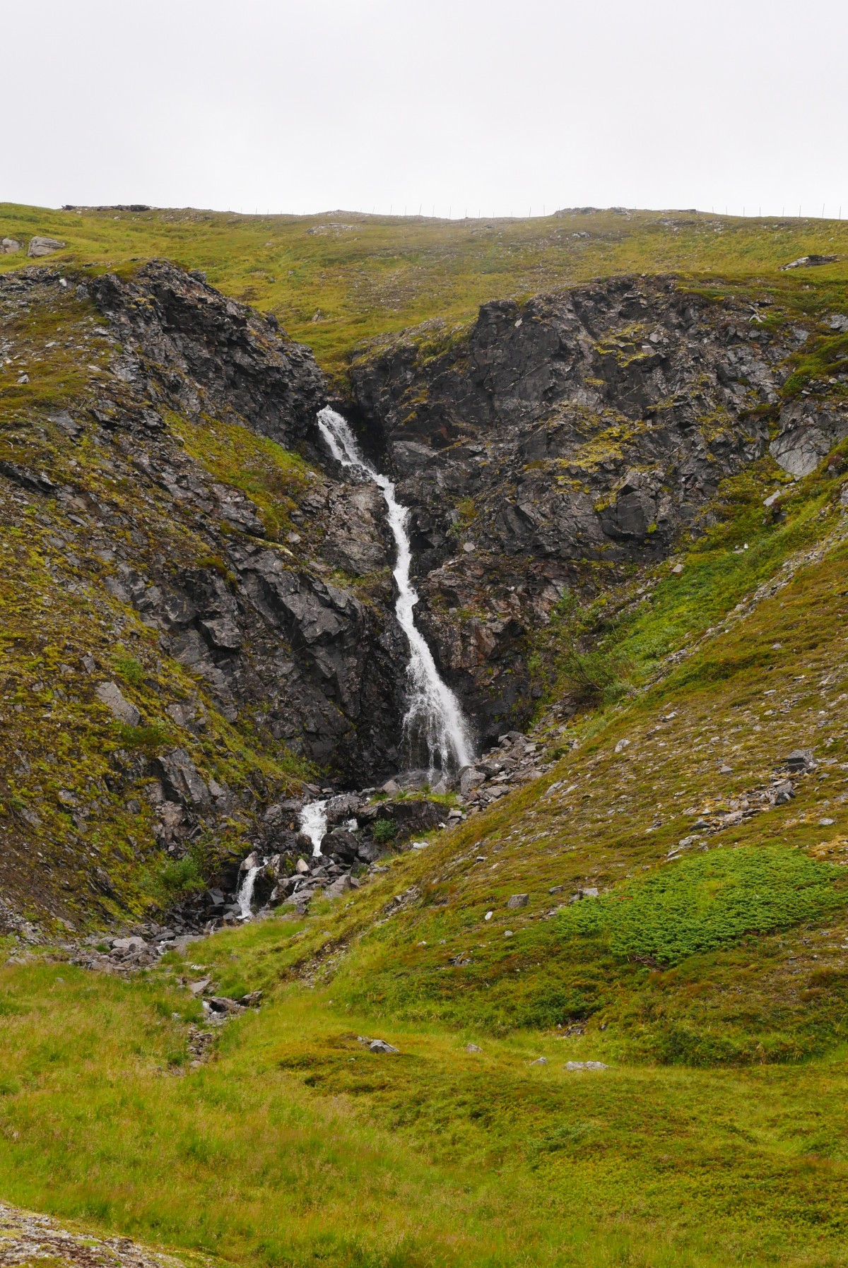
The tunnel is equipped with a continuous walkway in both directions of travel and the air quality is acceptable (at least in the morning before the opening of the Nordkapphallen). A crossing is therefore not too dangerous, but high-visibility vest and/or light are advisable and 90min can be expected. On the island the markings of the DNT are very rare and the way can often only be guessed with the help of GPS track. So we just stayed at the E69. After a small bridge at the very back of the bay we leave the E69 and head northwest. Where it gets steep there is an ATV track which probably represents the E1 here. It gets flatter again and you have a creek and a waterfall in front of you. You have to cross this stream, but this is possible in dry conditions. East of this creek it goes further uphill to a fence. One also has to cross this fence to stay on the right side of the creek. Past a lake and over a small tributary, the path continues in the same direction and is a little flatter uphill. From the top you can already see the small road to Gjesvaer and in good visibility the destination, the Nordkapp! On the small road back to the E69, which is supposedly only crossed. But on the other side there are no markings. But to follow the GPS track is quite easy here. The rest of the track is on/on the road. The small detour just before the Skarsvag junction is not marked.
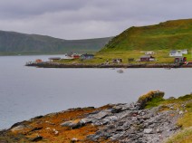
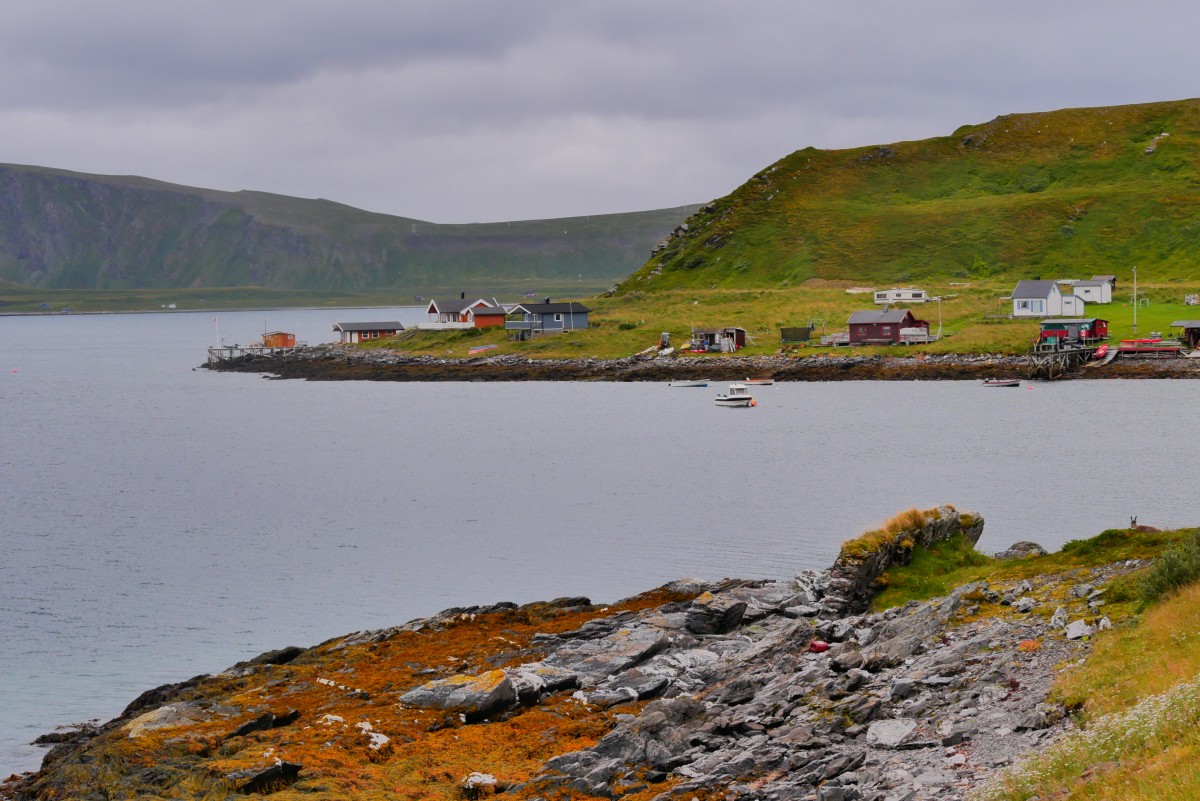
Directly behind the crossing is a camping site (tent from 180NOK) with cabins (from about 500NOK) and restaurant/breakfast at halfway reasonable prices.
(as of 01.08.2017)
Hiking maps
No maps added yet
Marking
-
 DNT Hiking Trail (Norway)
Accommodation
| Accommodation | Price group | |||
|---|---|---|---|---|
| 0-200 NOK |
201-400 NOK |
401-600 NOK |
>601 NOK |
|
|
Midnattsol Camping
Skarsvåg
Price group:
|
||||
Links
DNT - Stage descriptions (PDF)
Detailed information by the DNT about the E1 from North Cape (NO) to Grövelsjön (SE). Including stage descriptions, accomodation, marks and maps. In norwegian language.
Literature
Sources and copyright
GPX track coordinates: © OpenStreetMap contributors. Published under Open Database License (ODbL)GPX-Downloads
You can use the GPX track for navigation and tour planning on your digital device (GPS, smartphone, online tour planner).
| Etappe Stage 01.02 Skarsvåg Crossing - North Cape Tunnel | Download (.gpx) |
| All tracks in Norway, Finland and Sweden | Download (.zip) |
The download and many of the services offered on this page are free of charge. However, I would greatly appreciate a small donation as a token of appreciation for my work! This can be done through Paypal or a supporting membership. Thank you very much!