01.06 Hattir Øst - Duolbajarcopma
31.8km
Distance
-
Walking time
351m
Total climb
207m
Total descent
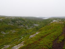
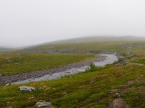
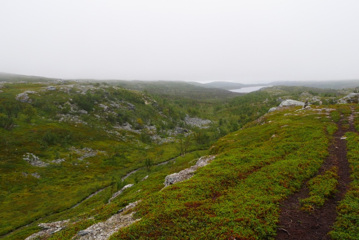
Photos

Stage description
N.B.: We don't have an English description of the stage just yet. We'll give you the German version for now until the English version is ready.
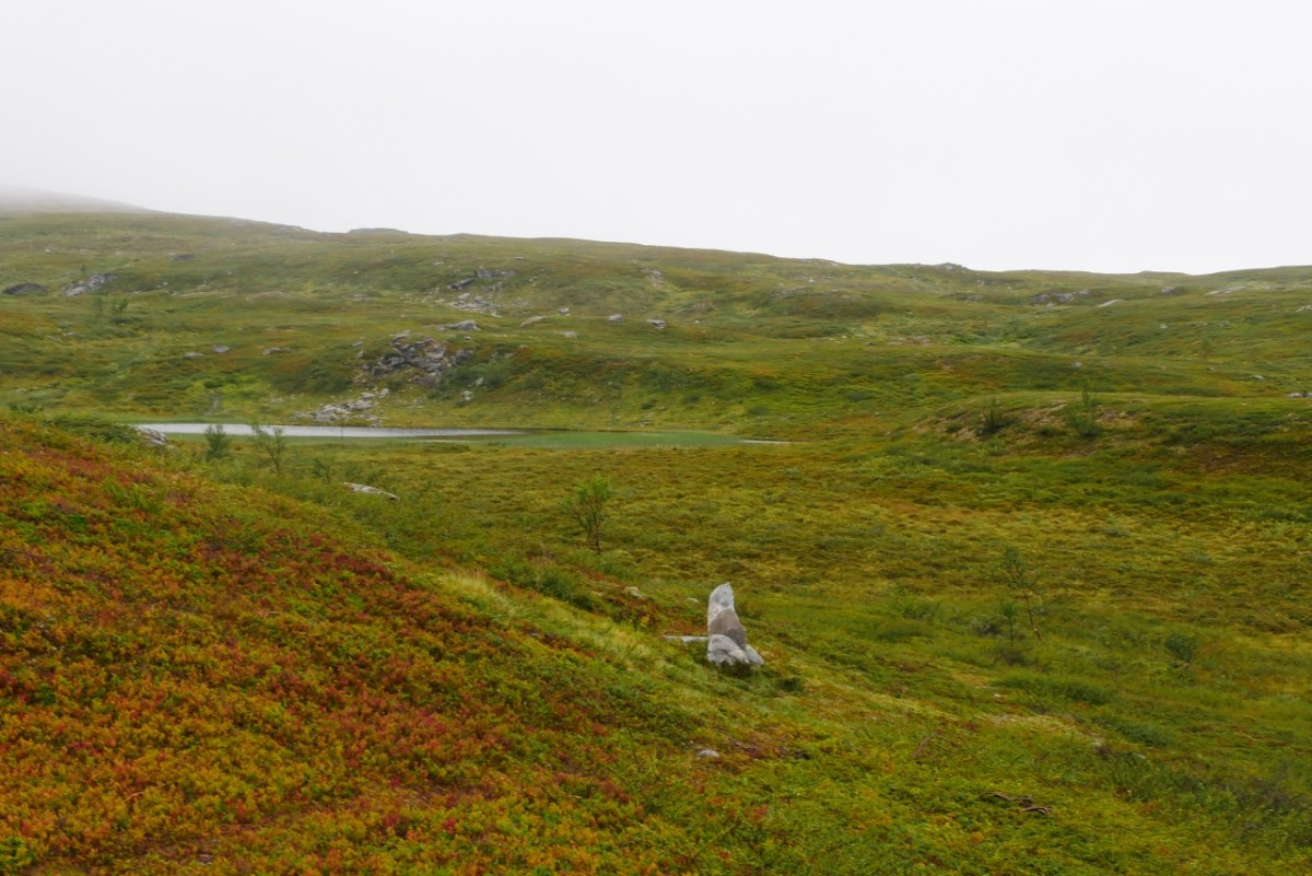
Bei den Häuschen von Hattir steht ein E1-Wegweiser und es geht erst steil auf einem Fahrweg hinauf. Bald wird es sanfter und nach den letzten Hütten wird der Wegzustand schlechter. Als Pfad geht es steil hinauf zu einer Abzweigung oberhalb des Sees Franssajavrit. Dort der letzte E 1-Wegweiser für viele Kilometer, rechts oberhalb vom See entlang. Dann durch ein Tal mit Birkenwald und sumpfigen Stellen, schließlich die Bachseite wechseln und steinig aufwärts. Ein stabiler Rentierzaun ohne Tor muss bei einem See auf dem Beg gekreuzt werden. Dann geht es wieder abwärts und durch feuchte Senken, bis bei Franssagielas etwas felsiges trockenes Terrain erreicht wird. Dann muss der Jovnnajohka gefurtet werden und jenseits geht es schlecht markiert südwärts durch ein Feuchtgebiet. Aufwärts zum Skaiddemohoaivi und wieder hinab zu einem leicht zu querenden Bach. Man nähert sich dann dem Skaidielva.
Man kreuzt eine Stromleitung. Weiter reicht diese Beschreibung nicht, weil der Verfasser zur Übernachtung eine offene Hütte nutzte, man an der Stromleitung entlang nach etwa 3,5 km am See Vuolit Goadehisjavri findet. Von /zu dieser Hütte in südlicher Richtung bietet es sich an, nicht durch die Feuchtgebiete westlich der Seen zu gehen, sondern östlich vom großen See Skaiddejavri zum Bereich Duolbajarcopma. Auch am Ostende des Sees Skaiddejavri gibt es eine offene Hütte.
Die folgende kurze Wegbeschreibung ist von Süd nach Nord verfasst:
Nasse Schuhe sind garantiert! Direkt nach der Querung des Flusses am Etappenanfang beginnt ein langes Stück Sumpf. Achtung: Die Markierung wechselt schon vor dem Fluss von Steinen bzw. Zaun zu etwa brusthohen Holzpfählen mit roter Spitze. Fast eine Stunde lang geht es durch dieses Feuchtgebiet. Erst nachdem man den Abfluss des Skaiddejavri durchwatet hat wird es trockener. Der Weg geht für einige Kilometer schön flach über die weiten grünen Hügel. Von links kommt der Fluss wieder in Sicht, der Weg erklimmt aber halb rechts einen Hügel. Nach dem Abstieg sind die Markierungen teils schwer zu finden, da der DNT hier kleine, dünne Jungbirken kaum erkennbar angestrichen hat. In einer weiten S-Kurve geht es an der östlichen Seite eines schönes Tales entlang, ehe dieses durchquert wird.
Nun folgen ein paar kurze Anstiege bis zu einem schönen See, der aber hinter dem allgegenwärtigen Zaun liegt. Wenig später steigt man zum ersten Mal seit einer Weile wieder in bewaldetes Gebiet ab. Der weitere Weg zur E6 hin ist gut markiert und großteils einfach zu gehen. Der E1 biegt hier nach links ab und folgt einem Waldweg 2,5km, bis er zum Ende über einen Schotterweg die Straße erreicht.
Hiking maps
No maps added yet
Marking
-
 DNT Hiking Trail (Norway)
Accommodation
| Accommodation | Price group | |||
|---|---|---|---|---|
| 0-200 NOK |
201-400 NOK |
401-600 NOK |
>601 NOK |
|
|
Hütte am See Vuolit Goadehisjavri
Billefjord
Price group:
|
||||
|
Hütte am Skaiddejavri
Ikkaldas
Price group:
|
||||
Links
DNT - Stage descriptions (PDF)
Detailed information by the DNT about the E1 from North Cape (NO) to Grövelsjön (SE). Including stage descriptions, accomodation, marks and maps. In norwegian language.
Literature
Sources and copyright
Information about accommodation, maps and marking of this stage is based on information by DNT (Den Norske Turistforening) - Published under CC BY-SA 4.0 License GPX track coordinates: © OpenStreetMap contributors. Published under Open Database License (ODbL)GPX-Downloads
You can use the GPX track for navigation and tour planning on your digital device (GPS, smartphone, online tour planner).
| Etappe Stage 01.06 Hattir Øst - Duolbajarcopma | Download (.gpx) |
| All tracks in Norway, Finland and Sweden | Download (.zip) |
The download and many of the services offered on this page are free of charge. However, I would greatly appreciate a small donation as a token of appreciation for my work! This can be done through Paypal or a supporting membership. Thank you very much!