04.11 Abetone - Lago Scaffaiolo
16.3km
Distance
-
Walking time
1412m
Total climb
962m
Total descent
Photos
Stage description
N.B.: We don't have an English description of the stage just yet. We'll give you the German version for now until the English version is ready.
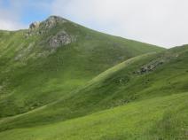
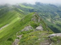
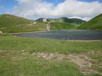
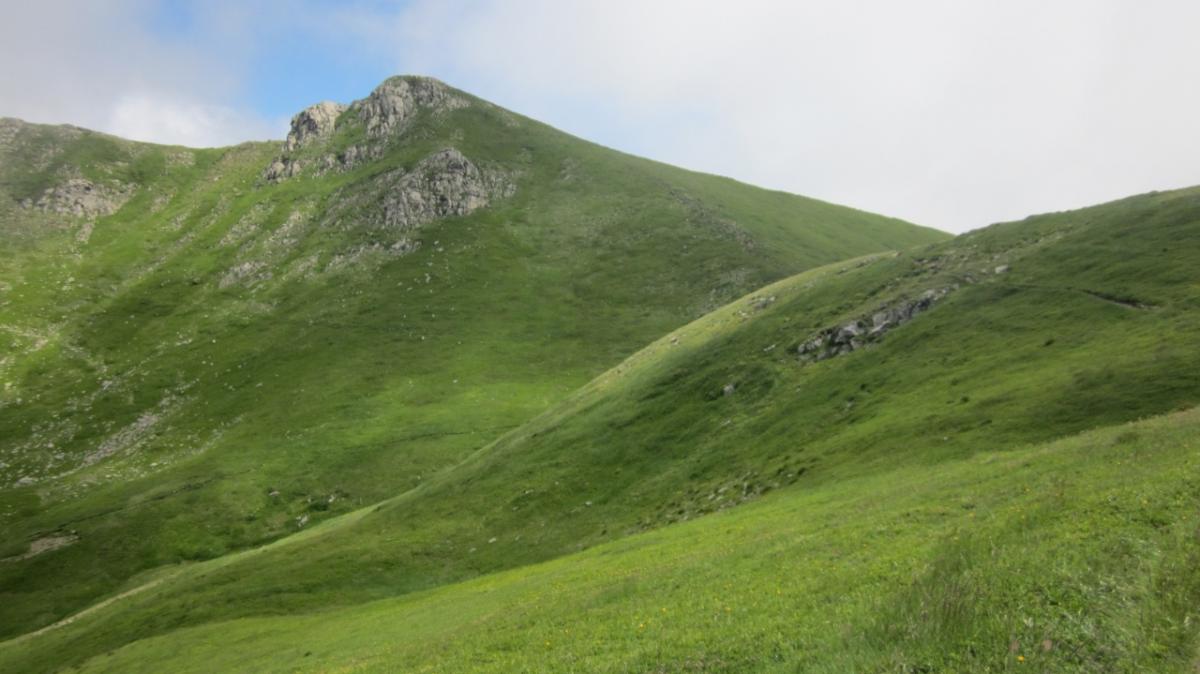
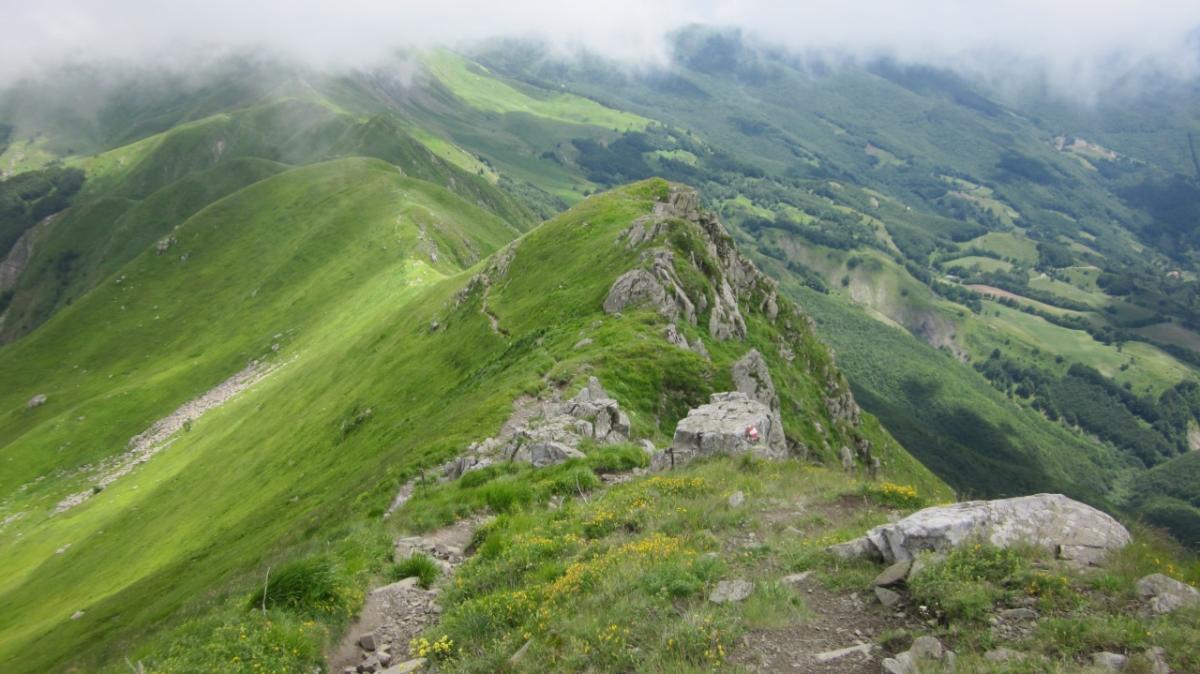
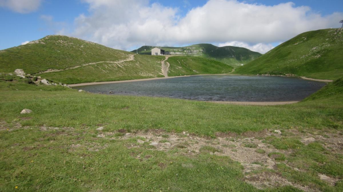
Durch den Wald geht es zunächst eben und dann langsam bergauf, wobei mehrere Bäche und nach ca. einer halben Stunde eine Quelle passiert werden. Hier sollte man unbedingt noch einmal Wasser auffüllen, da es im August und September keine weitere Auffüllmöglichkeit bis zum Etappenende gibt - und auch hier nur, wenn das bewirtschaftete Rifugio geöffnet hat. Nach der Kreuzung La Verginetta verlässt man die Bäume und es beginnt ein steiler Aufstieg über den Monte Belvedere bis zum Monte Rotondo. Ab hier folgt der Weg über Stunden dem höchsten Grat mit herrlichen Blicken zu beiden Seiten. Immer wieder ist jedoch höchste Konzentration gefragt und es gibt keine Möglichkeit, parallel zum Kamm auf weniger exponierten Wegen zu gehen - gutes Wetter ist daher ein Muss für diese Etappe! Am Etappenende wartet - sofern man reserviert hat - ein gut ausgestattetes Rifugio oder alternativ eine immer geöffnete, unbewirtschaftete Schutzhütte mit 4 metallenen Betten.
The following users contributed to this text:
Hiking maps
No maps added yet
Marking
-
 Grande Escursione Appenninica (GEA)
-
 Alta Via dei Parchi (AVP)
Accommodation
| Accommodation | Price group | |||
|---|---|---|---|---|
| 5-15 € | 16-30 € | 31-45 € | >45 € | |
|
Ostello Bucaneve
Abetone
Price group: 15-30 €
|
|
|||
|
Rifugio Capanna Tassoni
Fanano (MO)
Price group: €
|
||||
|
Rifugio CAI Duca degli Abruzzi
Fanano (MO)
Price group: €
|
||||
Links
Ambiente ER - Alta Via dei Parchi
Information about the 9th stage of the "Alta Via dei Parchi"
enrosadira.it - Emilia-Romagna / Tuscany / GEA
Information about the E1 in Emilia-Romagna and Tuscany.
Literature

Sources and copyright
GPX track coordinates: © OpenStreetMap contributors. Published under Open Database License (ODbL)GPX-Downloads
You can use the GPX track for navigation and tour planning on your digital device (GPS, smartphone, online tour planner).
| Etappe Stage 04.11 Abetone - Lago Scaffaiolo | Download (.gpx) |
| All tracks in Italy | Download (.zip) |
The download and many of the services offered on this page are free of charge. However, I would greatly appreciate a small donation as a token of appreciation for my work! This can be done through Paypal or a supporting membership. Thank you very much!