01.03 Gavirate - Sesto Calende
22.6km
Distance
-
Walking time
607m
Total climb
644m
Total descent
Photos
Stage description
N.B.: We don't have an English description of the stage just yet. We'll give you the German version for now until the English version is ready.
Hinweis: der folgende Text ist nicht mehr ganz aktuell, siehe "Nachtrag" weiter unten.
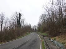
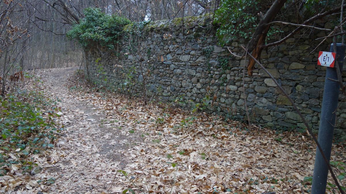
Zunächst geht es auf der Hauptstraße nach Bardello. Entlang des Lago di Varese folgt der Weg mit neuer Markierung nach Biandronno, wo ausreichend Übernachtungsmöglichkeiten existieren.
Weiter geht es vom See entfernt nach Casinetta Rizzone, weiter über kleine Hügel - die Landschaft verliert jetzt jeden alpinen Charakter -, dann längere Zeit auf einer Asphaltstraße nach Osmate, wo der Naturpark Ticino beginnt. Der Weg verläuft jetzt längere Zeit auf etwa gleicher Höhe entlang eines Hügels.
------------------
Nachtrag vom 16.08.18 von Rainer Minnerop
Diese Etappe ist so nicht mehr gehbar. Ich bin sie in etwas anderer Einteilung gestern und heute gelaufen.
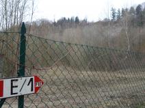
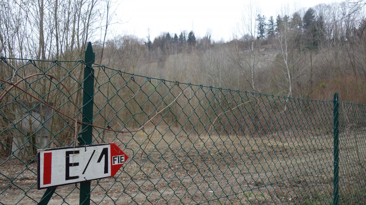
Hinter Gavirate kommt man nach einiger Zeit durch Biandronno. Danach verlief der Weg früher zwischen zwei Steinbrüchen. Diese sind vergrößert worden. Dabei wurde der E1 weggesprengt. Das Gelände ist weitläufig mit hohen Zäunen abgesperrt, wir kamen nur dadurch hinein, dass ein Baum den Zaun zerstört hatte. Aber wir kamen sehr schwer wieder hinaus. Diese Strecke muss komplett neu geplant werden.
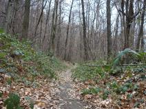
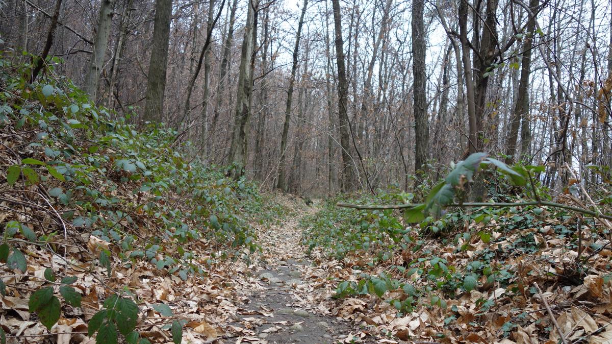
Im weiteren Verlauf kommt man in den Naturpark Tichino. Hier ist der Weg mit stacheligen Büschen und Brombeerranken total zugewuchert und nicht mehr passierbar. Ausführlicher Bericht mit Bildern hier, und folgenden Blogeintrag: Link zum ausführlichen Bericht
Hiking maps
No maps added yet
Marking
Accommodation
| Accommodation | Price group | |||
|---|---|---|---|---|
| 5-15 € | 16-30 € | 31-45 € | >45 € | |
|
Dolcelago Lake and Cake
Gavirate
Price group: >45 €
|
|
|||
|
B&B La Folaga
Gavirate
Price group: >45 €
|
|
|||
|
Camping Lago di Monate
Comabbio VA
Price group: €
|
||||
|
Elly B&B
Sesto Calende VA
Price group: €
|
||||
|
B&B Coco Loco
Sesto Calende VA
Price group: €
|
||||
|
Camping Turist Il Gabbiano
Golasecca VA
Price group: €
|
||||
|
Show more accommodation in Gavirate
, Travedona
, Ternate
and Sesto Calende
(booking.com / Ad)
|
||||
Links
enrosadira.it - Lombardy North
Information about the E1 in northern Lombardy.
Sources and copyright
GPX track coordinates: © OpenStreetMap contributors. Published under Open Database License (ODbL)GPX-Downloads
You can use the GPX track for navigation and tour planning on your digital device (GPS, smartphone, online tour planner).
| Etappe Stage 01.03 Gavirate - Sesto Calende | Download (.gpx) |
| All tracks in Italy | Download (.zip) |
The download and many of the services offered on this page are free of charge. However, I would greatly appreciate a small donation as a token of appreciation for my work! This can be done through Paypal or a supporting membership. Thank you very much!