2.01 Rapperswil - Einsiedeln
15.6km
Distance
-
Walking time
727m
Total climb
231m
Total descent
Photos
Stage description
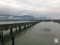
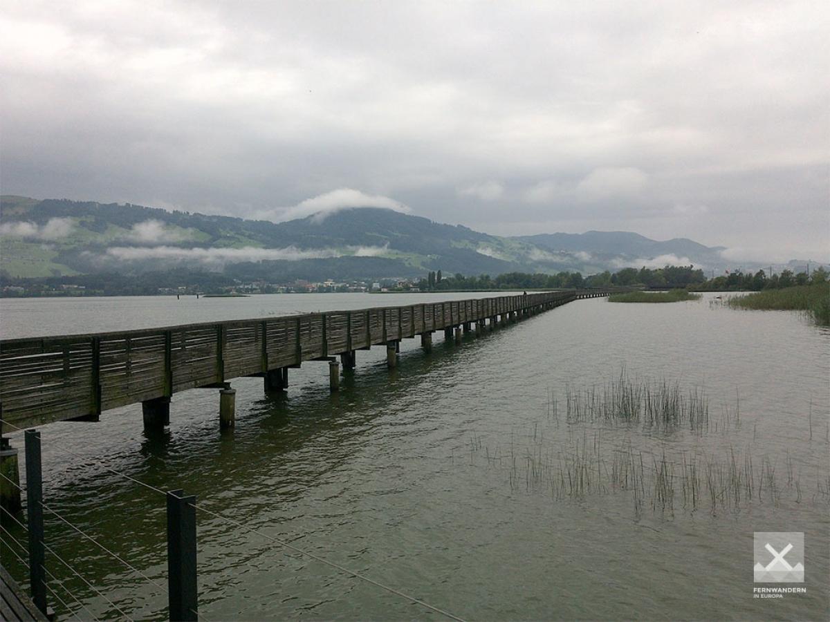
The E1 follows Route 4 (Via Jacobi / Schwabenweg) for the entire stage. Before the European long-distance hiking trail was completely transferred to this Wanderland route, the stage led on a high-level trail east around the Sihl lake and crossed it on a bridge in the direction of Einsiedeln (marked blue on the map). Those who are not afraid of a few extra kilometres should definitely follow this somewhat longer, original E1 route. You will be rewarded with a great view (e.g. from Stöcklichrüz) of past landscapes in the direction of Lake Zurich and Hörnli and of the more alpine terrain ahead.
Hiking maps
No maps added yet
Marking
-
 Via Jacobi
-
 Hiking trail (Switzerland)
Accommodation
| Accommodation | Price group | |||
|---|---|---|---|---|
| 5-25 CHF |
26-50 CHF |
51-75 CHF |
>75 CHF |
|
|
Campingplatz Strandbad Stampf
Jona
Price group: CHF 5-25
|
|
|||
|
Jugendherberge Rapperswil-Jona
Jona (SG)
Price group: CHF 25-50
|
|
|||
|
Lützelhof
Pfäffikon SZ
Price group: CHF 5-25,CHF 25-50
|
|
|
||
|
Haflingerhof
Egg SZ
Price group: 15-30,30-45
|
|
|
||
|
Campingplatz Grüene Aff
Willerzell
Price group: 15-30
|
|
|||
|
Hotel Allegro
Einsiedeln
Price group: CHF 50-75
|
|
|||
|
Show more accommodation in Rapperswil-Jona
, Pfäffikon
and Einsiedeln
(booking.com / Ad)
|
||||
Sights
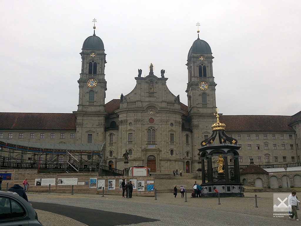
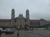
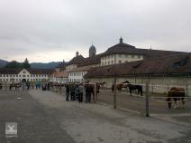
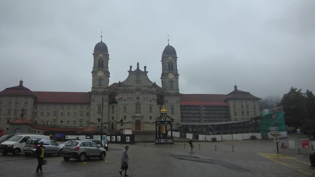
Kloster Einsiedeln (Einsiedeln Abbey)
The E1 leads from the shore of the Sihl lake up to Einsiedeln. Shortly before the end of the stage we can see the village and the monastery from a small hill. This Benedictine abbey is an important pilgrimage station on the Swiss St. James' Way. It houses a "Black Madonna", an attraction for pilgrims and tourists.
The abbey also offers pilgrims an overnight accommodation.
Links
Stage details at jakobsweg.ch
https://www.jakobsweg.ch/en/eu/ch/routes/constance-einsiedeln-en/rapperswil-einsiedeln-en/
ViaJacobi: Rapperswil (SG) – Einsiedeln
Stage description on schweizmobil.ch
https://www.schweizmobil.ch/en/wanderland/routes/etappe-01177.html
Literature
Sources and copyright
GPX track coordinates: © OpenStreetMap contributors. Published under Open Database License (ODbL)GPX-Downloads
You can use the GPX track for navigation and tour planning on your digital device (GPS, smartphone, online tour planner).
| Etappe Stage 2.01 Rapperswil - Einsiedeln | Download (.gpx) |
| Ehemaliger Verlauf des E1 | Download (.gpx) |
| All tracks in Switzerland | Download (.zip) |
The download and many of the services offered on this page are free of charge. However, I would greatly appreciate a small donation as a token of appreciation for my work! This can be done through Paypal or a supporting membership. Thank you very much!