2.02 Einsiedeln - Brunnen
24.6km
Distance
-
Walking time
687m
Total climb
1150m
Total descent
Photos

Stage description
N.B.: We don't have an English description of the stage just yet. We'll give you the German version for now until the English version is ready.
Es lohnt sich einen Tag für die Besteigung des Großen Mythen einzuplanen.
Hiking maps
No maps added yet
Marking
-
 Hiking trail (Switzerland)
Accommodation
| Accommodation | Price group | |||
|---|---|---|---|---|
| 5-25 CHF |
26-50 CHF |
51-75 CHF |
>75 CHF |
|
|
Hotel Allegro
Einsiedeln
Price group: CHF 50-75
|
|
|||
|
Alp Hochweid
Schwyz
Price group: CHF 5-25
|
|
|||
|
Berggasthaus Haggenegg
Schwyz
Price group:
|
||||
|
Hirschen backpackers.hotel.pub
Schwyz
Price group: CHF 25-50
|
|
|||
|
Chlosterhof
Ingenbohl-Brunnen
Price group: CHF 25-50
|
|
|||
|
Camping Hopfreben
Brunnen
Price group: CHF 5-25
|
|
|||
|
Camping Urmiberg
Brunnen
Price group: CHF 5-25
|
|
|||
|
Show more accommodation in Einsiedeln
, Schwyz
and Brunnen
(booking.com / Ad)
|
||||
Sights
-
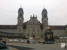
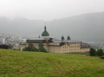
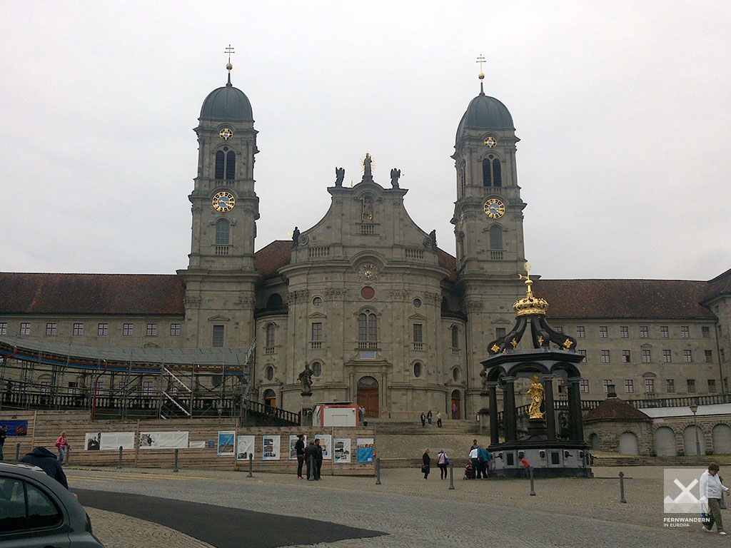
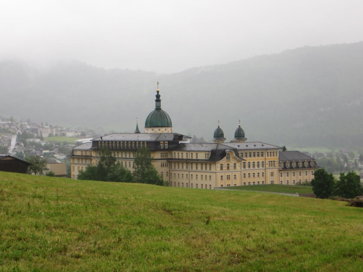
Kloster Einsiedeln (Einsiedeln Abbey)
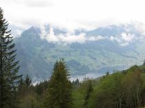
The E1 leads from the shore of the Sihl lake up to Einsiedeln. Shortly before the end of the stage we can see the village and the monastery from a small hill. This Benedictine abbey is an important pilgrimage station on the Swiss St. James' Way. It houses a "Black Madonna", an attraction for pilgrims and tourists.
The abbey also offers pilgrims an overnight accommodation.
-
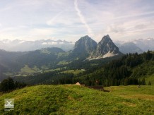
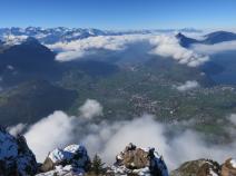
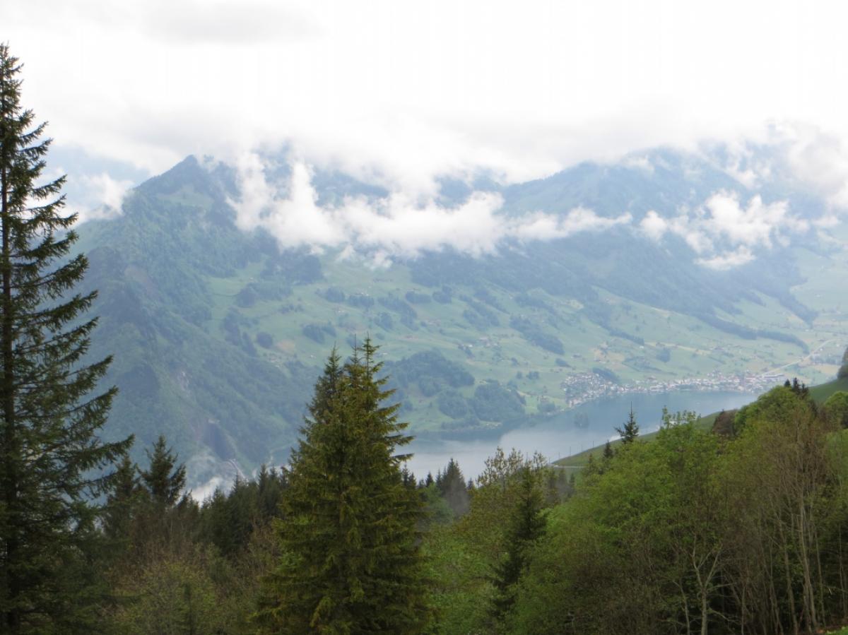
Mythen
The Mythen, a striking mountain massif consisting of the two peaks "Großer Mythen" (1,898m) and "Kleiner Mythen" (1,811m) are the landmark of Canton Schwyz.

Links
Stage details at jakobsweg.ch
https://www.jakobsweg.ch/en/eu/ch/routes/einsiedeln-bruenig-en/einsiedeln-brunnen-en/
ViaJacobi: Einsiedeln – Schwyz
Stage description on wanderland.ch
Literature
Sources and copyright
GPX track coordinates: © OpenStreetMap contributors. Published under Open Database License (ODbL)GPX-Downloads
You can use the GPX track for navigation and tour planning on your digital device (GPS, smartphone, online tour planner).
| Etappe Stage 2.02 Einsiedeln - Brunnen | Download (.gpx) |
| All tracks in Switzerland | Download (.zip) |
The download and many of the services offered on this page are free of charge. However, I would greatly appreciate a small donation as a token of appreciation for my work! This can be done through Paypal or a supporting membership. Thank you very much!