2.01 Nørre Snede - Givskud
21.7km
Distance
-
Walking time
216m
Total climb
238m
Total descent
Photos
Stage description
N.B.: We don't have an English description of the stage just yet. We'll give you the German version for now until the English version is ready.
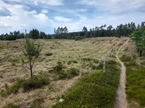
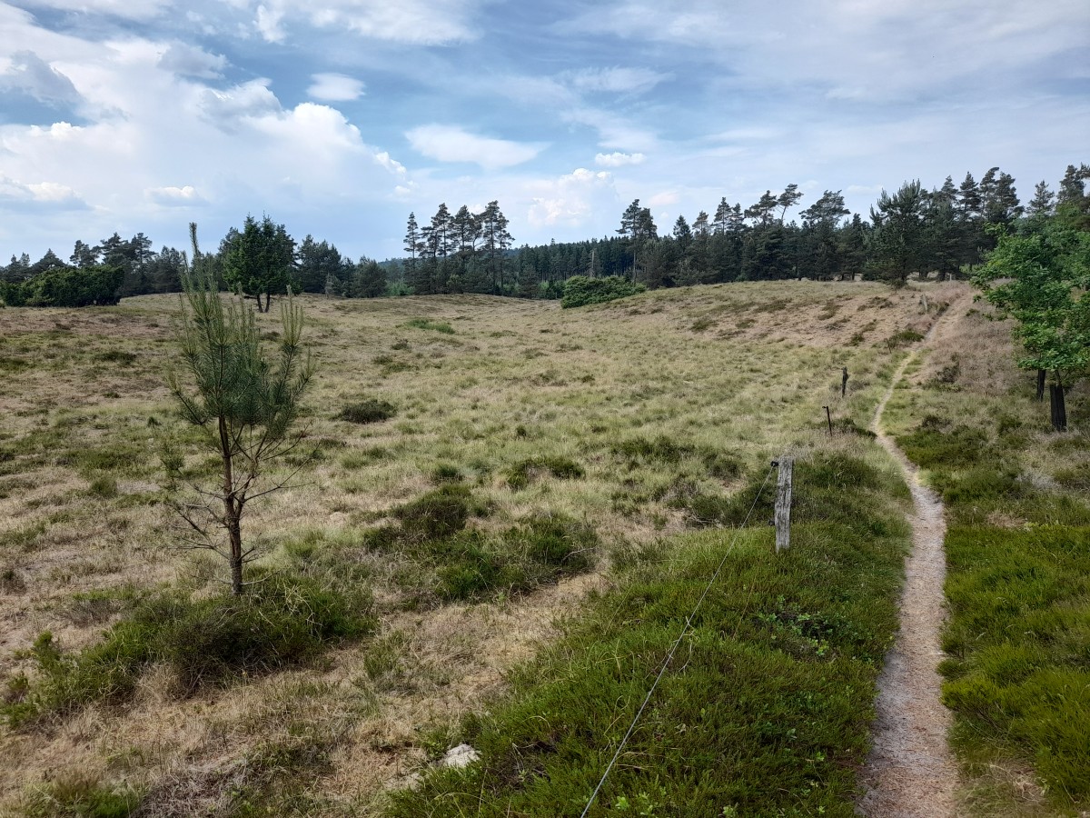
Am Anfang geht die Strecke durch eine bergige Landschaft mit schönen Seen und Flusstälern, danach folgen Felder und Wiesen. Schon aus der Ferne sieht man die Sankt-Peders Kilde auf einem Hügel, von dem sich eine schöne Sicht bietet. Am Ortsausgang von Kollemorten biegt der Wanderweg links von der Straße ab und macht einen großen Bogen über die Felder bis nach Givskud.
The following users contributed to this text:
Hiking maps
No maps added yet
Marking
-
 Hiking trail (Denmark)
Accommodation
| Accommodation | Price group | |||
|---|---|---|---|---|
| 0-150 DKK |
151-300 DKK |
301-450 DKK |
>450 DKK |
|
|
Højderyggens shelterplads
Nørre Snede
Price group:
|
||||
|
Koutrupgård Shelterplads
Price group:
|
||||
|
Hærvejscenter Kollemorten
Kollemorten
Price group:
|
||||
|
Danhostel Givskud Zoo
Give
Price group: DKK 150-300
|
|
|||
|
Givskud naturlejrplads
Price group:
|
||||
|
Show more accommodation in Givskud
(booking.com / Ad)
|
||||
Links
haervej.com
Stage description including a printable map
http://www.haervej.com/ln-int/haervej/hiking-stage-nr-snede-givskud-aprox-227-km
Literature

Sources and copyright
GPX track coordinates: © OpenStreetMap contributors. Published under Open Database License (ODbL)GPX-Downloads
You can use the GPX track for navigation and tour planning on your digital device (GPS, smartphone, online tour planner).
| Etappe Stage 2.01 Nørre Snede - Givskud | Download (.gpx) |
| All tracks in Denmark | Download (.zip) |
The download and many of the services offered on this page are free of charge. However, I would greatly appreciate a small donation as a token of appreciation for my work! This can be done through Paypal or a supporting membership. Thank you very much!